Overnight yesterday and today (12 September), a wildfire that had been burning near Waterton Lakes National Park exploded in size and triggered mass evacuations. This post is motivated in part by the stories that have continuously emerged from western Canada in the summer of 2017. Stories of people evacuating in the middle of the night with 20 minutes notice; stories of people losing everything they owned, their livestock, their pets. Stories of the fire crews and support crews and volunteers who have worked incredibly hard throughout the summer to minimize the damage and support those affected by the fires.
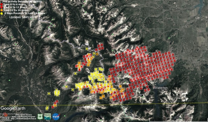
Overnight growth of the Waterton Lake wildfire. Fire activity detected from MODIS satellites, and shown in a Google Earth .kml layer (available at https://fsapps.nwcg.gov/googleearth.php)
In western Canada, from the Prairies to the Central Interior of British Columbia (BC), the summer of 2017 was hot by any standard. How hot was it? I coded up a simple Google Earth Engine script to calculate average daytime and nighttime surface temperatures for July and August 2017, and compared these with the average between 2000 and 2016 (Figure 1). The code uses surface temperatures measured from the MODIS Aqua satellite operated by NASA (MYD11A1).
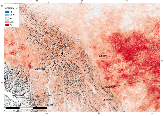
Daytime surface temperature anomalies for July and August 2017, from MODIS TERRA. Anomaly is calculated as the difference between mean temperatures in 2017 and the mean temperatures observed between 2003 and 2016
Daytime surface temperatures in July and August were up to +5 C warmer than the 2002-2016 average (Figure 1) over a large part of the prairies, and between 0 and +2 C warmer through much of southern BC. More than 1200 wildfires burned over 11,000 square kilometers in BC alone through most of the summer, leading to the evacuation of more than 45,000 people from their homes. Interestingly, nighttime temperatures on the prairies were close to normal, but 2-3 C above normal in the mountains.
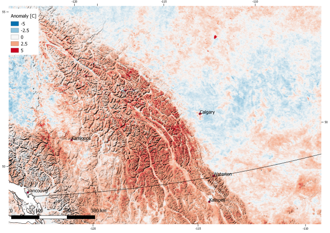
Nighttime surface temperature anomalies for July and August 2017, from MODIS TERRA.
Is the summer of 2017 a preview of the new normal? Average annual temperature increases of 4-7 C are projected for much of western Canada by the end of the century, depending on which emissions scenario the world follows. While moisture and forest management techniques are also an important part of the wildfire equation, the way human activities are changing the atmosphere will result in increased extreme fire weather conditions, and a longer fire season.
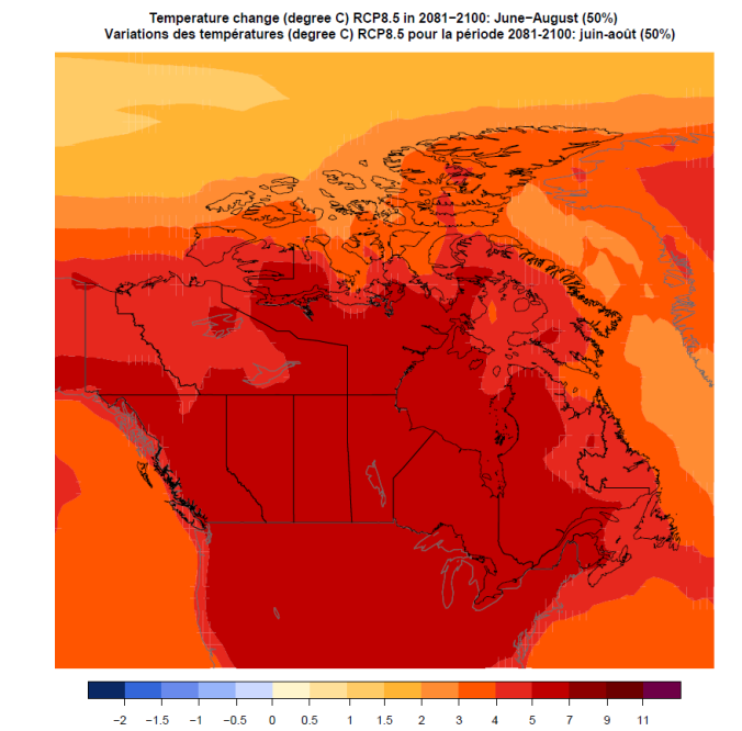
Projected summer temperature change by 2080-2100 under RCP8.5 (high emission scenario), from Environment and Climate Change Canada. Changes are relative to average temperatures between 1986 and 2005. Details here: http://climate-scenarios.canada.ca/index.php?page=download-cmip5
